Old Maps of Louisville
Contents
- 1961 Louisville Transit Company System Map
- 1989 Transit Authority of River City System Map (NEW 2010-07-10)
- Excerpt from TARC’s 1999 System Map
- 1932 Wagner Map of Louisville
- Why Is It Called Outer Loop?
- Coleman’s 1982 Map of Louisville
- It's not a map: Louisville Railway Company Taylor–6th Timetable from 1950
The old page [from 2008] is also available. It’s much more wordy and cringey though. [and some of the links don't work. and I haven't been able to restore its images thus far.]
1961 Louisville Transit Company System Map
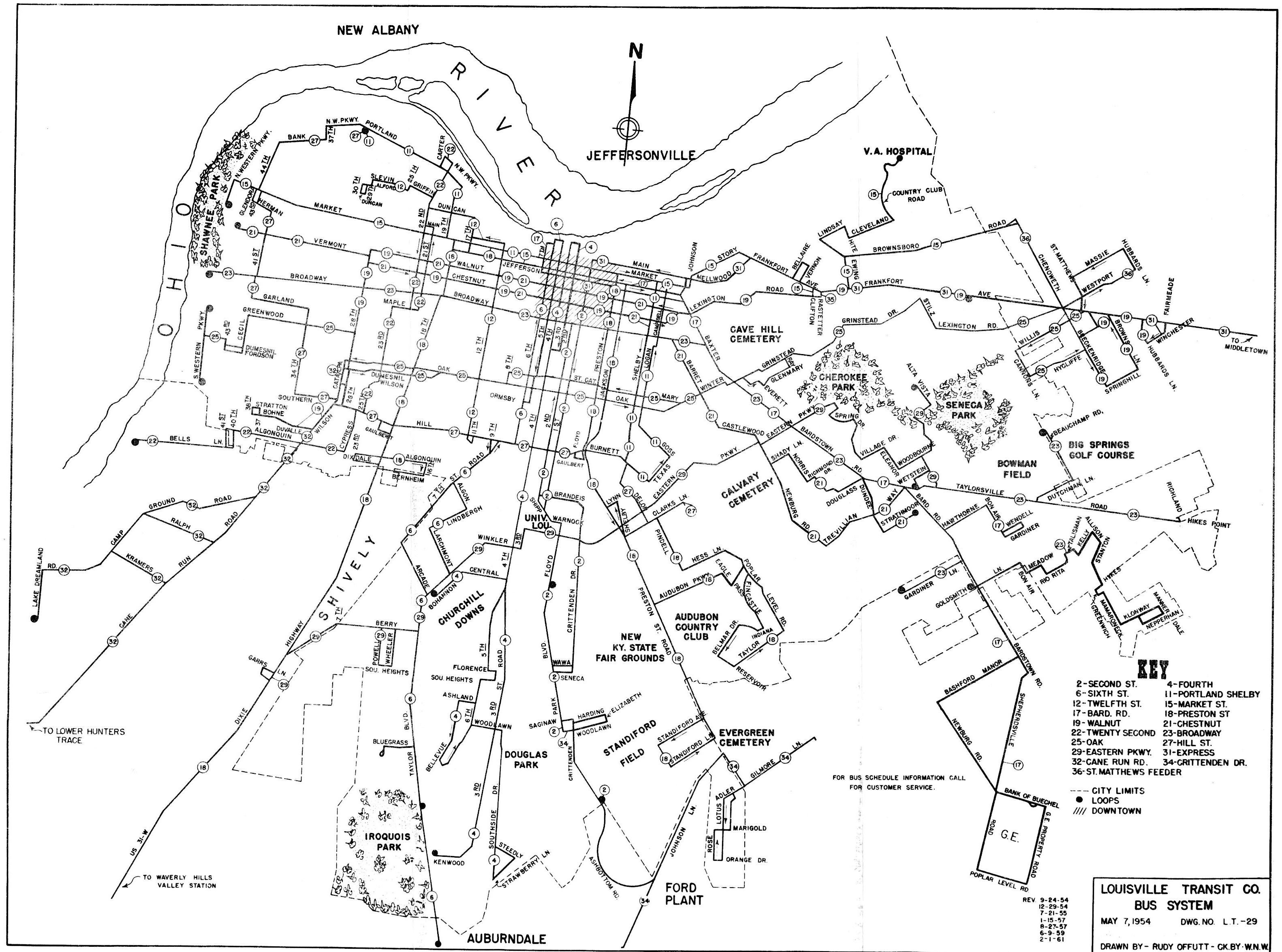
Click to download.
This rather simple pocket map that fit on a letter-sized sheet of paper dates back to the Louisville Transit Company era (c. 1950–1974). A list of Louisville Transit routes in 1961:
- 2 — Second Street
- 4 — Fourth Street
- 6 — Sixth Street
- 11 — Portland–Shelby
- 12 — Twelfth Street
- 15 — Market Street
- 17 — Bardstown Road
- 18 — Preston–18th
- 19 — Walnut Street
- 21 — Chestnut Street
- 22 — Twenty-Second Street
- 23 — Broadway
- 25 — Oak Street
- 27 — Hill Street
- 29 — Eastern Parkway
- 31 — Middletown Express
- 32 — Cane Run Road
- 34 — Crittenden Drive
- 36 — St. Matthews Feeder
This map is a revision of a base map created in 1954. It was found amongst some other maps of Lexington and Louisville I purchased on an eBay auction. The bus route numbering system was also created in 1954, started appearing on buses’ destination signs in 1961, and is still in use today. Though most of these routes have since been extended to serve outlying suburban areas, most route names, numbers, and their general routings within the old city boundaries, remain the same.
1989 Transit Authority of River City System Map
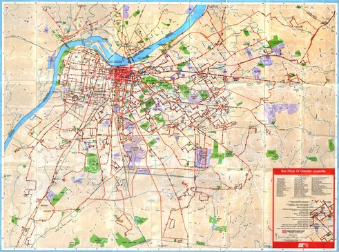
Download (right-click/save-as recommended):
150dpi, 4913×3651 JPG, 2.4MB
75dpi, 2457×1826 JPG, 1.4MB
The Transit Authority of River City’s 1989 system map is a larger full-color folded map credited to “Icon of KY” that also displays all city streets. Interestingly, it also displayed the location of all bus shelters at the time. I believe this design was originally published in 1981, which is also listed as a copyright date on this map.
A list of all TARC routes, as shown on this map, in 1989:
- 2 — Second Street
- 4 — Fourth Street
- 6 — Sixth Street
- 11 — Portland–Shelby
- 12 — Twelfth Street
- 15 — Market Street
- 17 — Bardstown Road
- 18 — Preston—18th
- 19 — Muhammad Ali Boulevard
- 21 — Chestnut Street
- 22 — Twenty-Second Street
- 23 — Broadway
- 25 — Oak Street
- 27 — Hill Street
- 29 — Eastern Parkway
- 31 — Middletown
- 37 — Fourth Street Express
- 38 — Sixth Street Express
- 40 — Jeffersontown
- 43 — Poplar Level Road
- 44 — St. Regis Park
- 45 — Okolona Express
- 46 — 26th Street GE Express
- 47 — 42nd Street GE Express
- 48 — Fairdale Express
- 49 — Westport Express
- 50 — Dixie/Kosmosdale Express
- 51 — Fourth Avenue Circulator
- 52 — Medical Center Circulator
- 53 — Breckenridge Express
- 54 — Manslick Express
- 55 — Hounz Lane
- 56 — Ford and GE Express (Watson)
- 57 — Ford and GE Express (Deering)
- 58 — Bashford Manor–Oxmoor
- 59 — River Road
- 60 — Highview Express
- 61 — Plainview Express
- 62 — Breckenridge Lane–Shepherdsville Road
- 63 — Crums Lane
- 64 — Oldham County Express
- 65 — Bullitt County/
Shepherdsville (Local) - 66 — Mt. Washington/
Shepherdsville Express - 68 — Prospect Express
- 69 — New Albany Express
- 70 — Clarksville Express
- 71 — Jeffersonville Express
- 72 — New Albany/
Clarksville/ Jeffersonville - 73 — Charlestown Road Express
Excerpt from TARC’s 1999 System Map
1999:
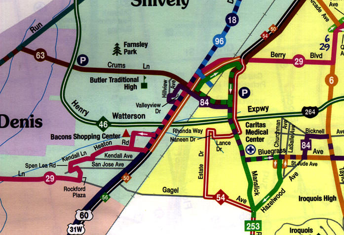
Since 1989, TARC did not publish a system map until late in the 1990s. This one from 1999, designed by G. D. Nelson Mapping Services of Denver, CO, indicated each line with a different color, and a different convention indicated express routes. Only major roads were shown.
TARC’s current system and downtown maps are available as PDFs or in a Flash viewer (launches new window; requires Flash). They were redesigned for 2006, and show all city streets once again.
1932 Wagner Map of Louisville
Cover and map![[cover and map]](images/louisville-wagner-1932/2g.jpg)
Cover, folded out![[cover folded out]](images/louisville-wagner-1932/1g.jpg)
Downtown Map: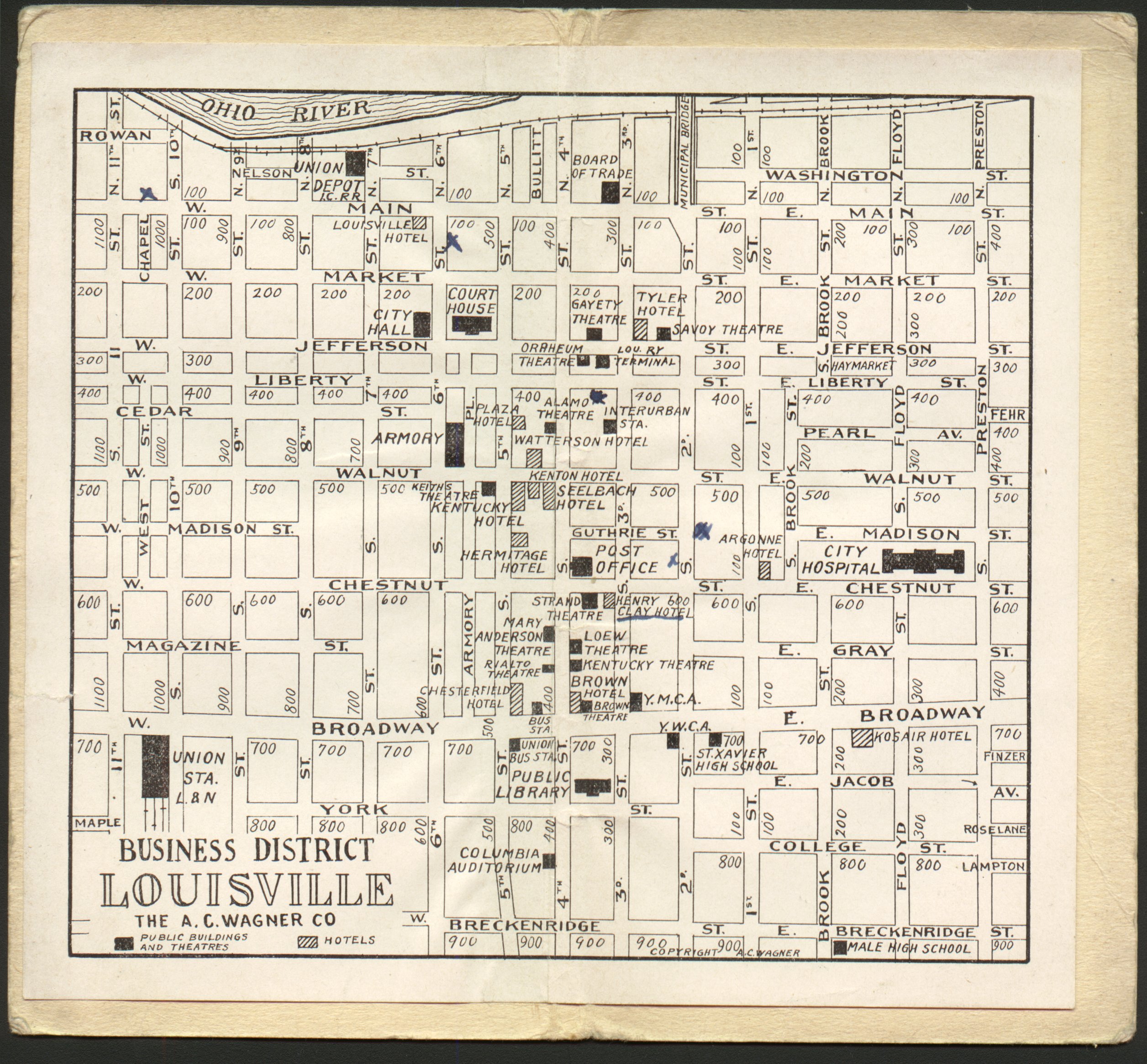
This was glued to the inside of the cover. Handy!
Detail of Main Map: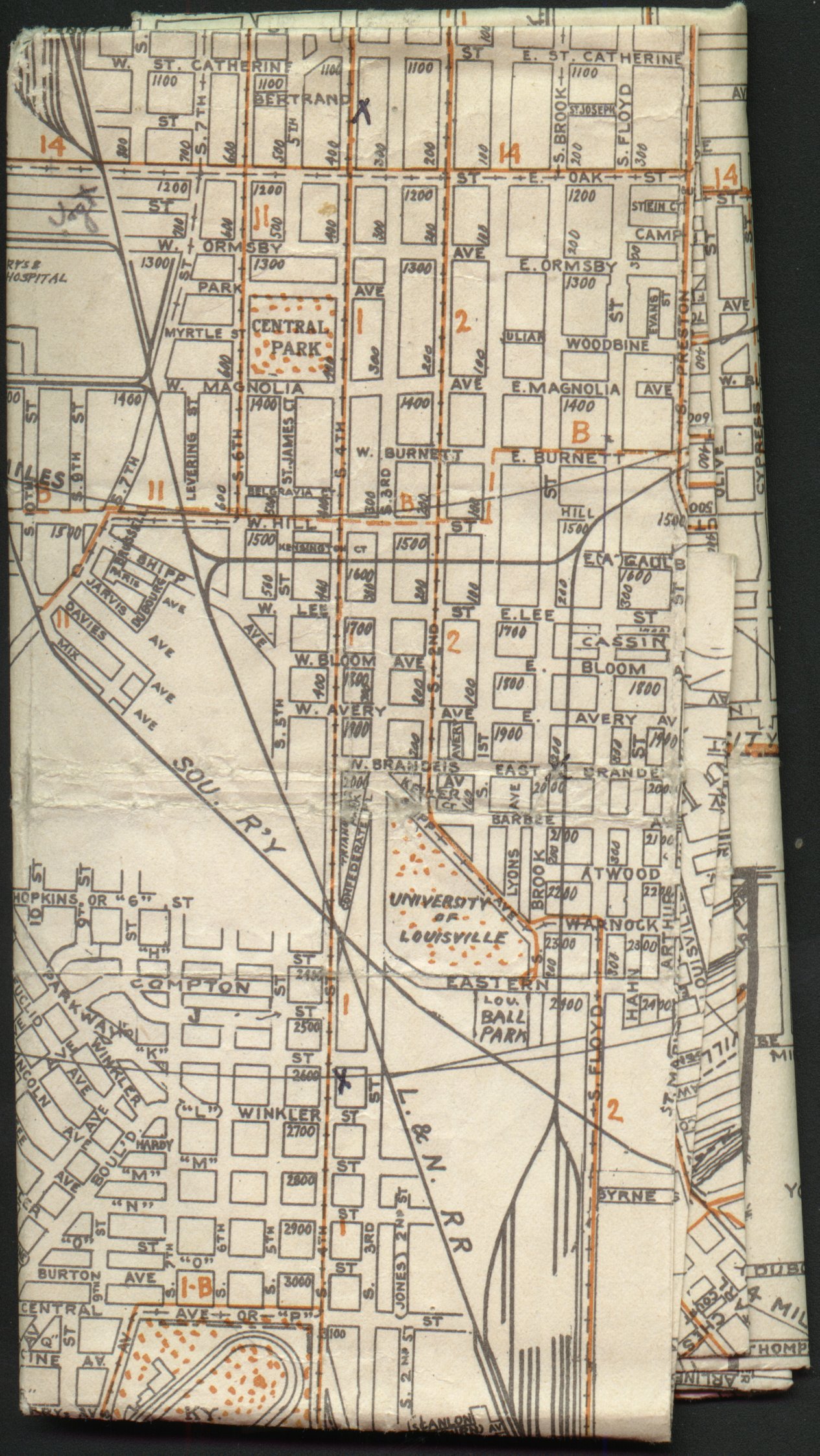
Solid orange lines indicated streetcar lines; dotted orange lines indicated bus lines.
Why Is It Called Outer Loop?

This excerpt from a 1961 Gousha map of Louisville indicates that an original proposal for the outer beltway around Louisville was going to connect to the existing Cross-County Highway (now known as Outer Loop). Since then they decided to build a new alignment parallel to and south of the Cross-County Highway (on the current alignment of the Snyder), but somehow the Cross-County became Outer Loop anyway.
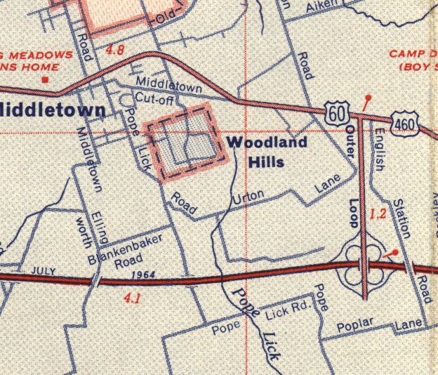
This comes from a 1964 Rand McNally map of Louisville. As of 1964 one portion of this Outer Loop was already open, providing a detour for I-64 traffic to Shelbyville Road until I-64 was completed closer to Louisville. The cloverleaf interchange between I-64 and the now Gene Snyder Freeway still exists in its original form as of December 2008.
Coleman’s 1982 Map of Louisville
A map of Louisville so bad it’s good.
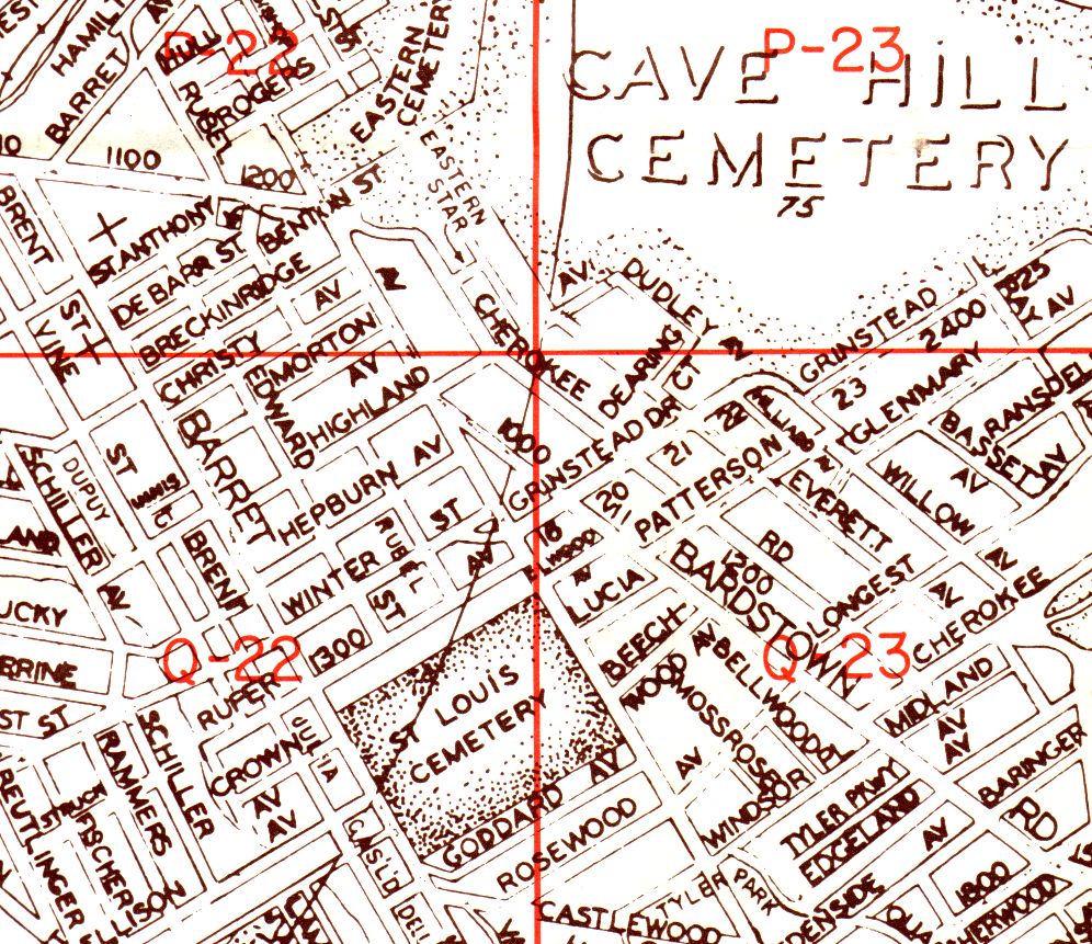
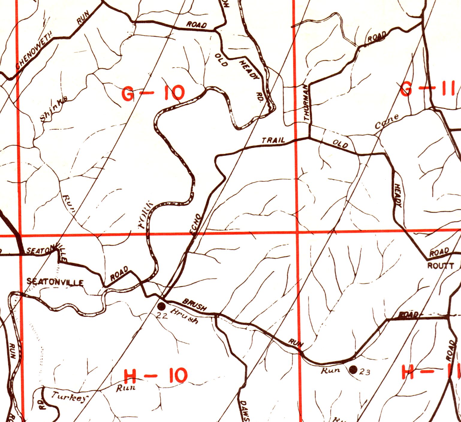
Originally, Coleman’s map was quite a fine piece of black-and-white cartography. The city side showed all streets in the City of Louisville and displayed block numbers; the county side showed the entire county and all streets outside the City.
The Highlands section of the city map and the southeastern section of the county map are shown here. Their areas have seen almost no new streets added for decades as of 1982; their sections of the map have accordingly not seen sloppy changes like the ones shown below.
Brace yourself.
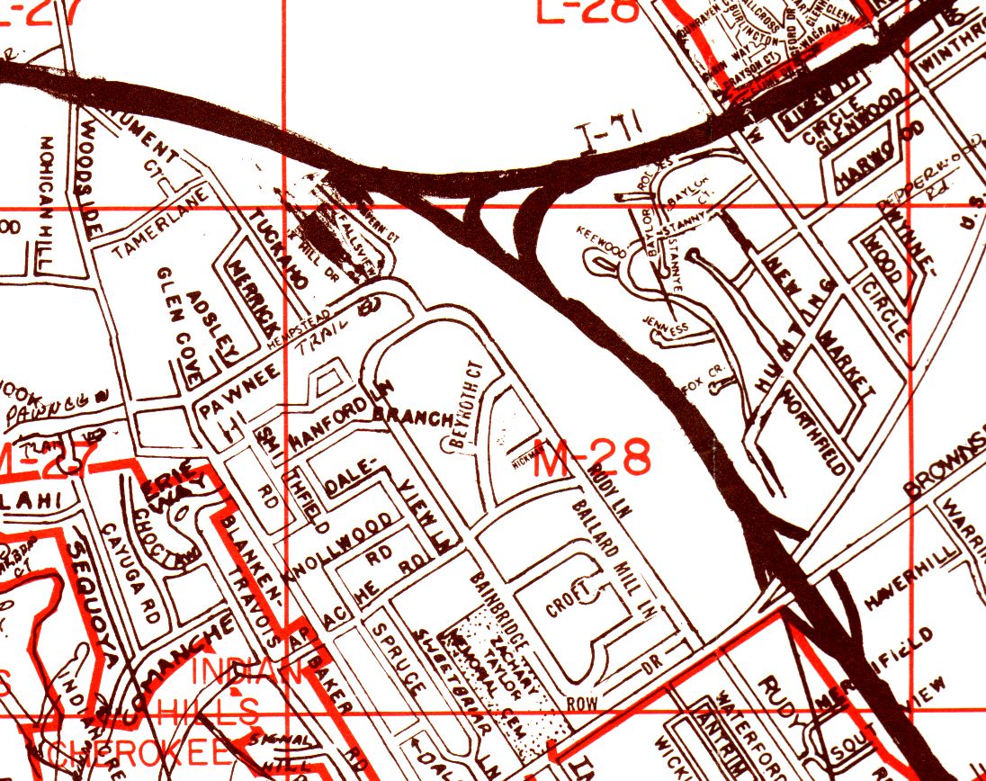
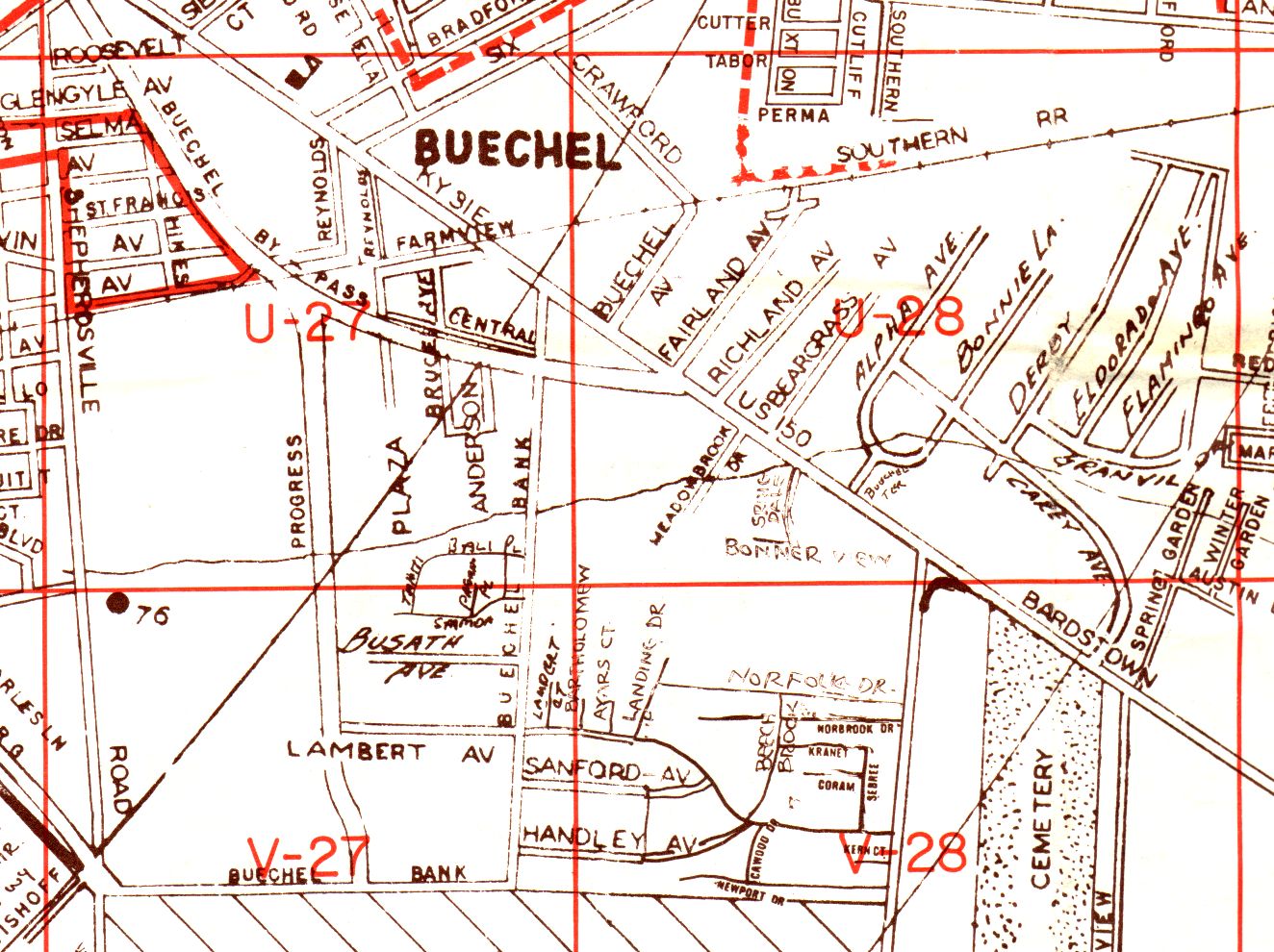
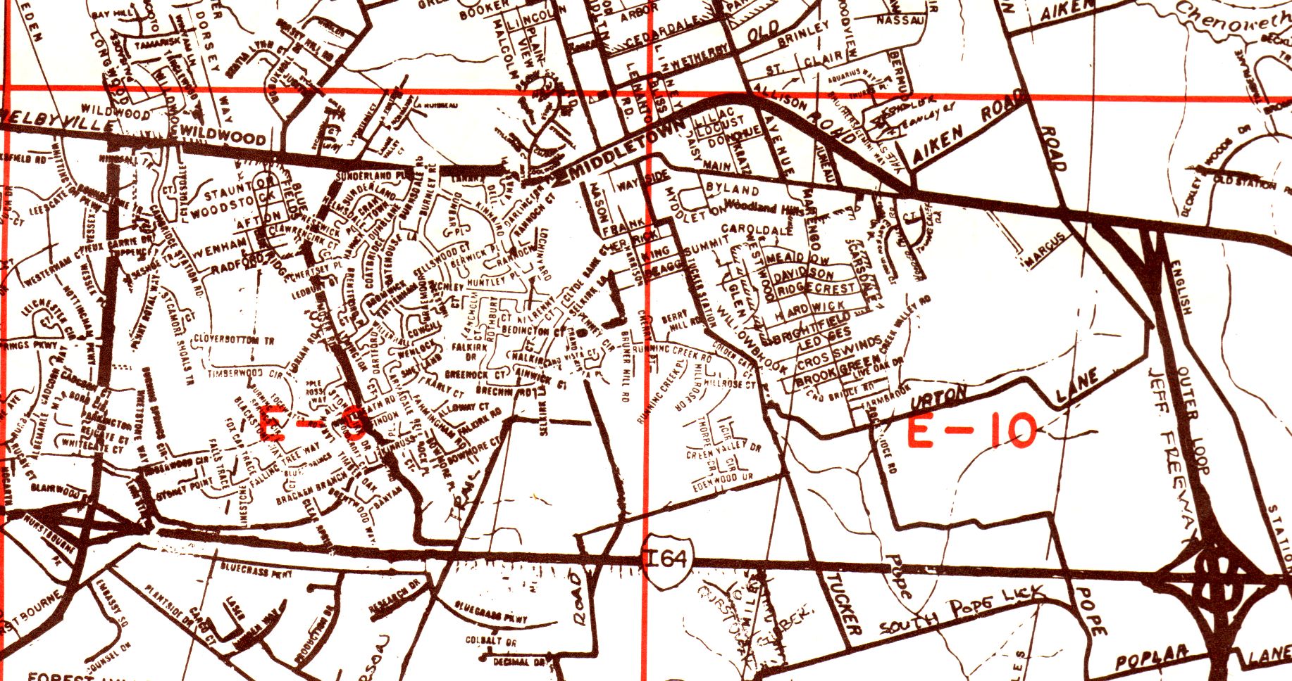
On suburban sections of the city and county maps, we see numerous changes done sloppily, with no consistent style, some hand-drawn. Old streets removed to make way for freeways were still displayed. The Middletown excerpt from the county map appears to contain large excerpts of Metro Graphic Arts cartography. Whether Metro Graphic Arts was plagirized, I can’t say.
One final note. Coleman's map did not cover Southern Indiana, nor any portions of Kentucky outside Jefferson County.
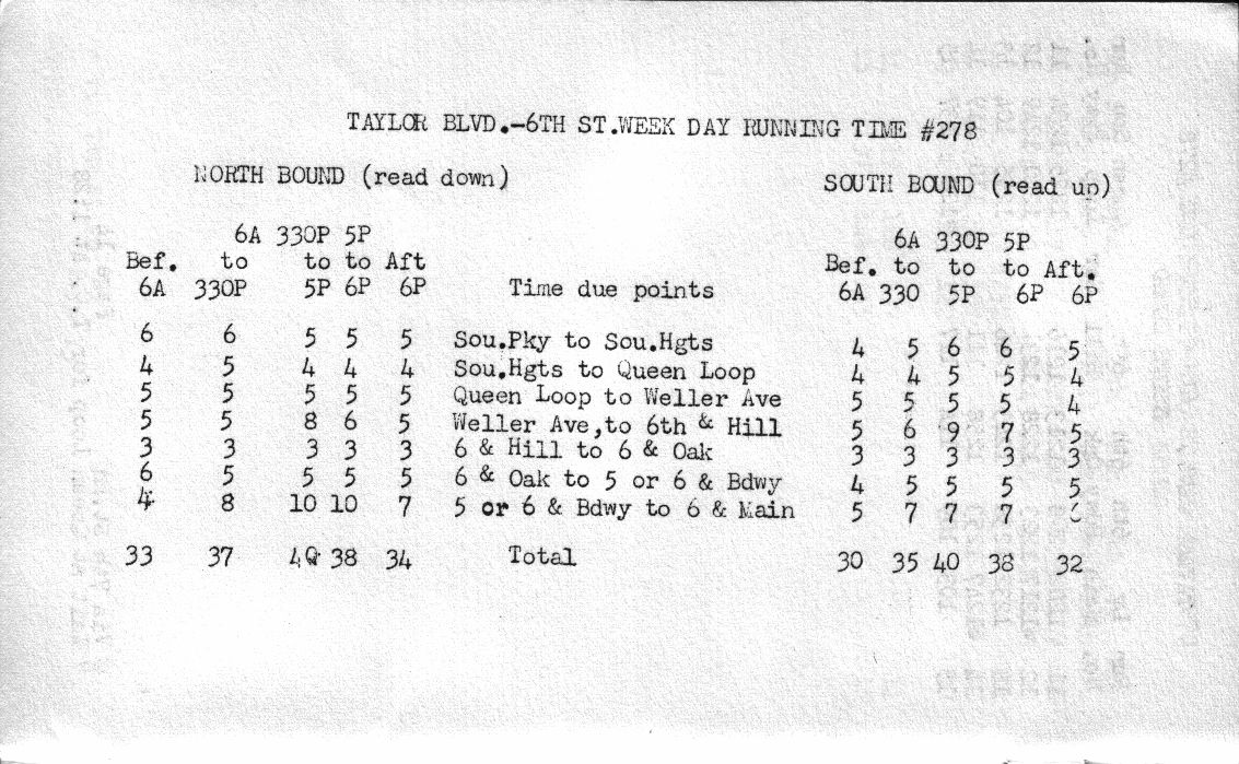
It's not a map: Louisville Railway Company Taylor–6th Timetable from 1950
The Louisville Railway Company
Taylor Blvd. – 6th St.
Week Day
Schedule #278
Effective Oct. 30th, 1950
Back then, the buses on this line ran every 15 minutes early mornings and late night, and every 2–5 minutes during rush hour.
According to Wikipedia, The Louisville Railway Company operated its last streetcar in 1940 and renamed itself the Louisville Transit Company in 1951.
Cover page: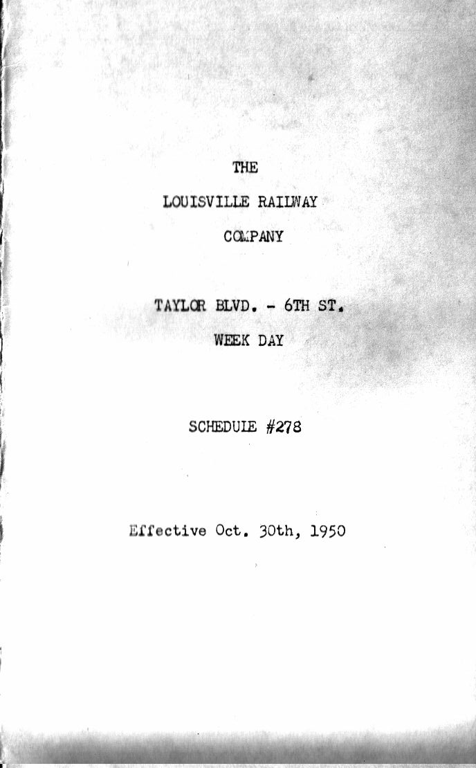
Pages 1–2: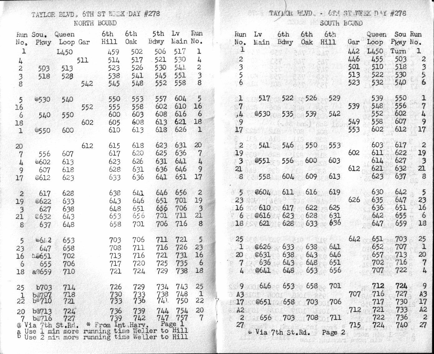
Pages 3–4: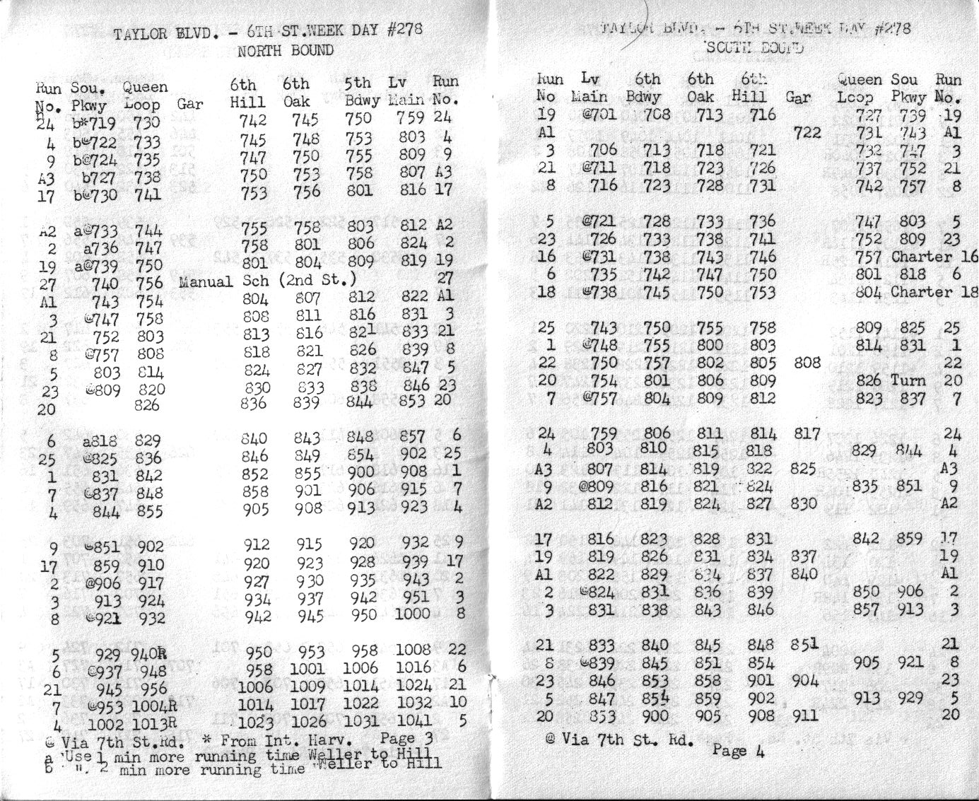
Pages 5–6: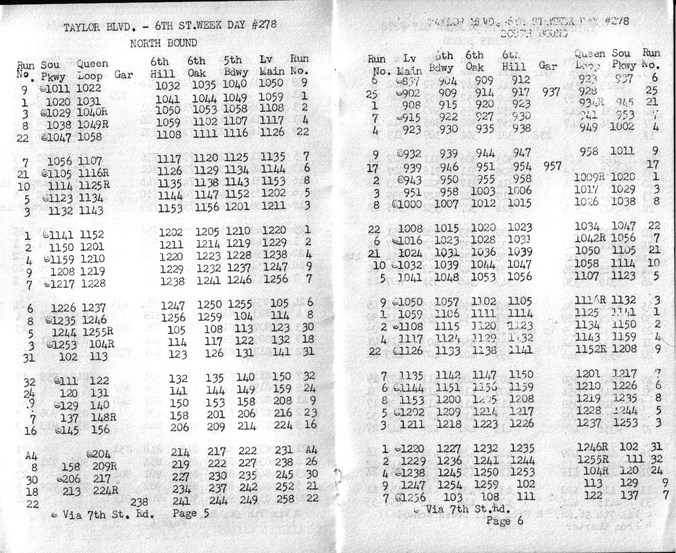
Pages 7–8: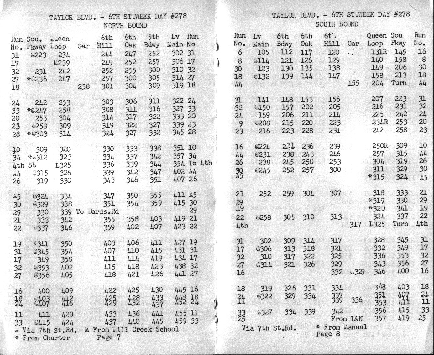
Pages 9–10: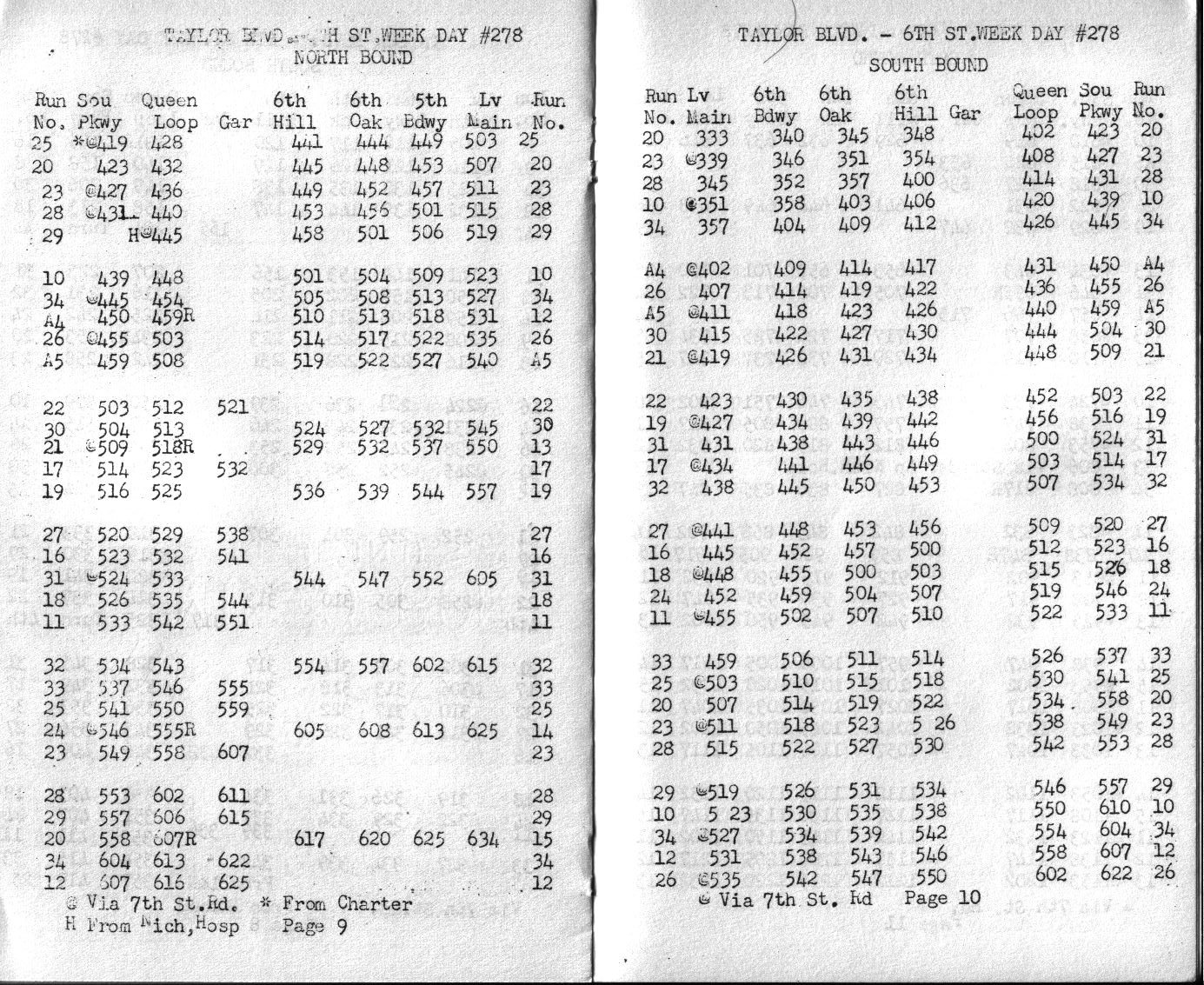
Pages 11–12: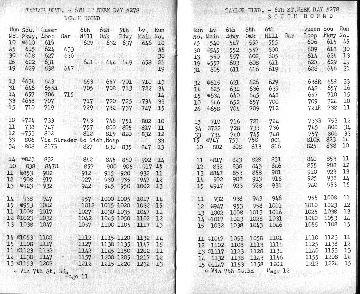
Pages 13–14: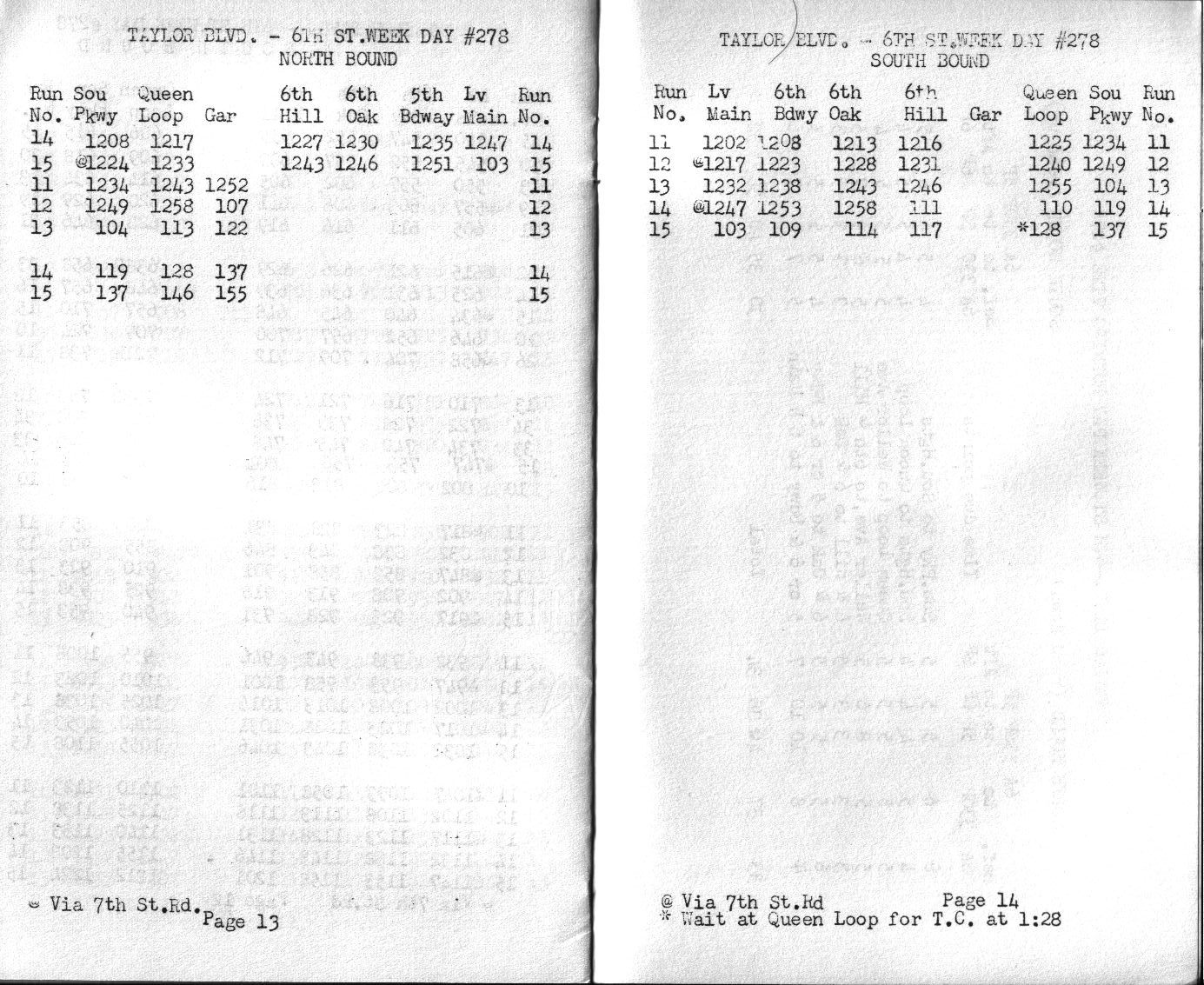
Page 15, listing running times between major stops by hour: